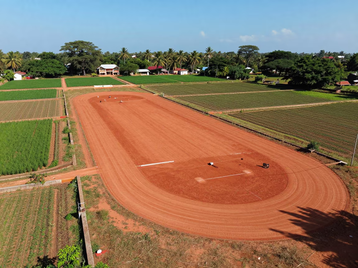
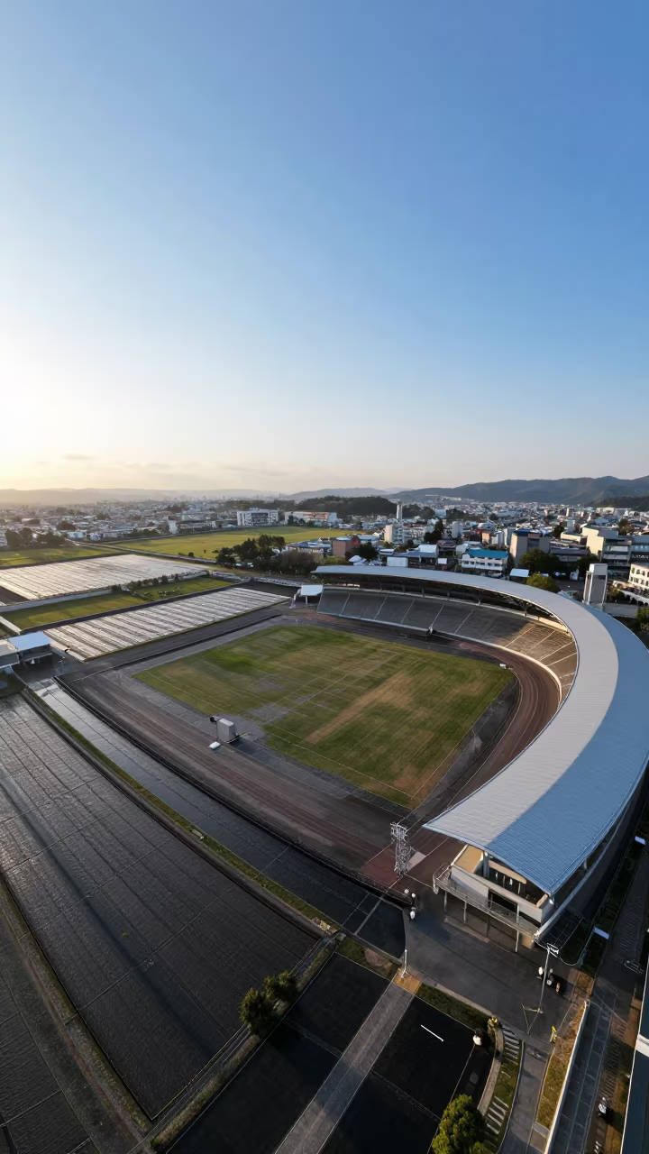
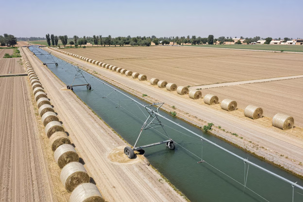
Aerial View of Sports Complex and Irrigation Fields
Tropical midday light floods the landscape near Tiruchirappalli, casting sharp shadows from the curved red clay running tracks that slice through the green field. The sports complex sits adjacent to a vast irrigation network, where geometric channels of water reflect the cloudless blue sky in precise parallel lines. Earth tones of dry soil border the vibrant emerald crops, marking the turn between seasons. The rule of thirds places the athletic oval against the sweeping agricultural grid, highlighting the contrast between human recreation and systematic farming. A white starting block rests on the track surface, its paint slightly faded by the intense sun.
Free to download. CDN hosting requires a link back to this page. Terms
Similar Images
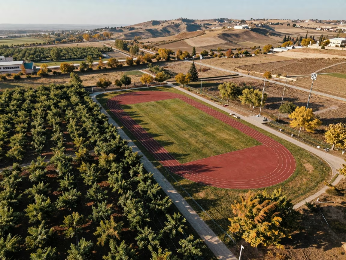
Aerial Sports Complex Near Adana Orchards
Aerial View of Zimbabwe Sports Complex Tracks
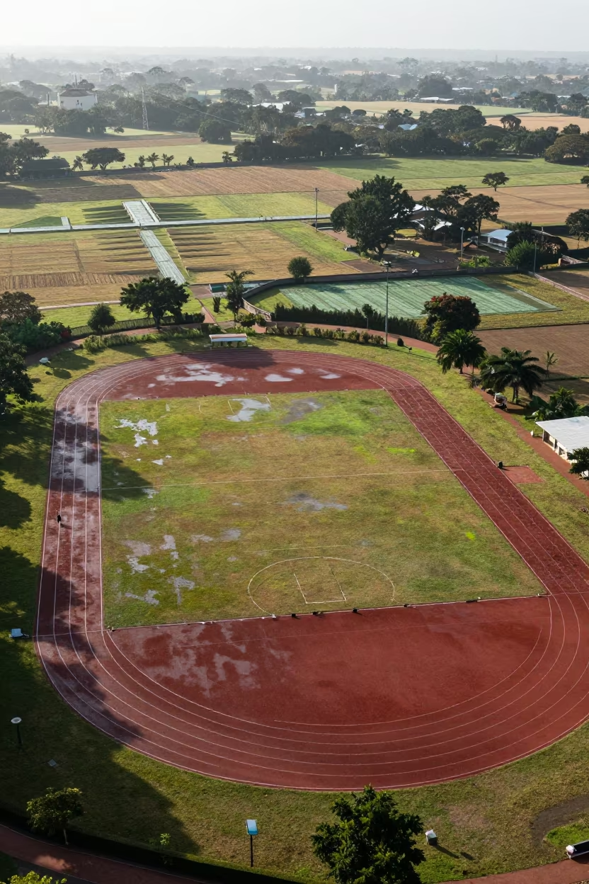
Aerial View of Mauritius Sports Complex Tracks
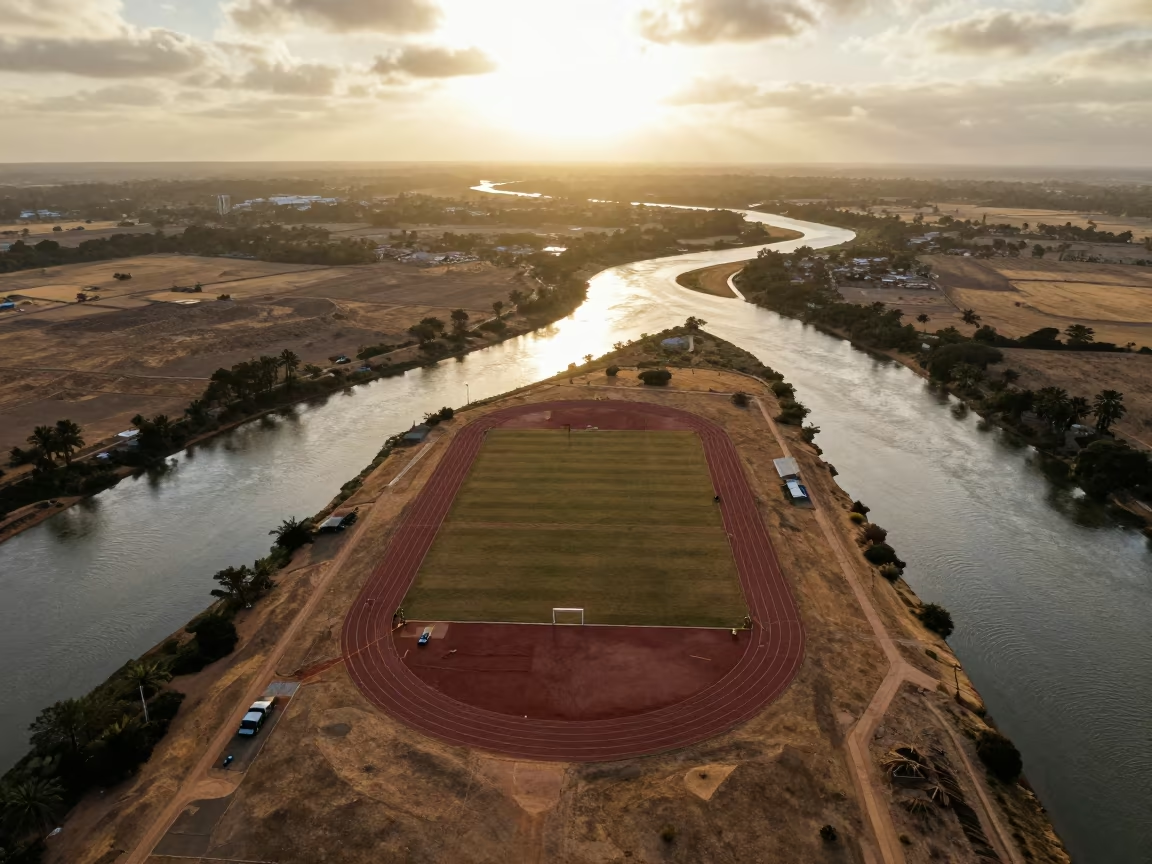
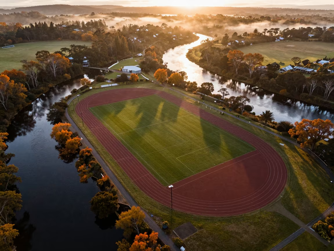
Aerial View of Sports Track Over Braided River
Aerial View of Australian Irrigation Geometry
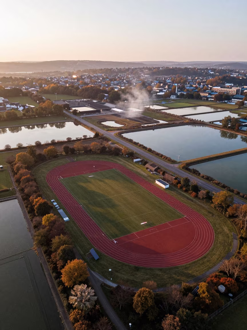
Autumn Salt Ponds and Track Complex Aerial View
Sunset aerial view of sports track near Kobe orchards
Aerial View of Sports Complex Near Braided Rivers
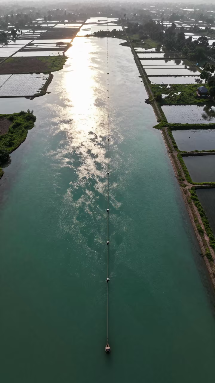
Jade Lagoon Irrigation Geometry Aerial View
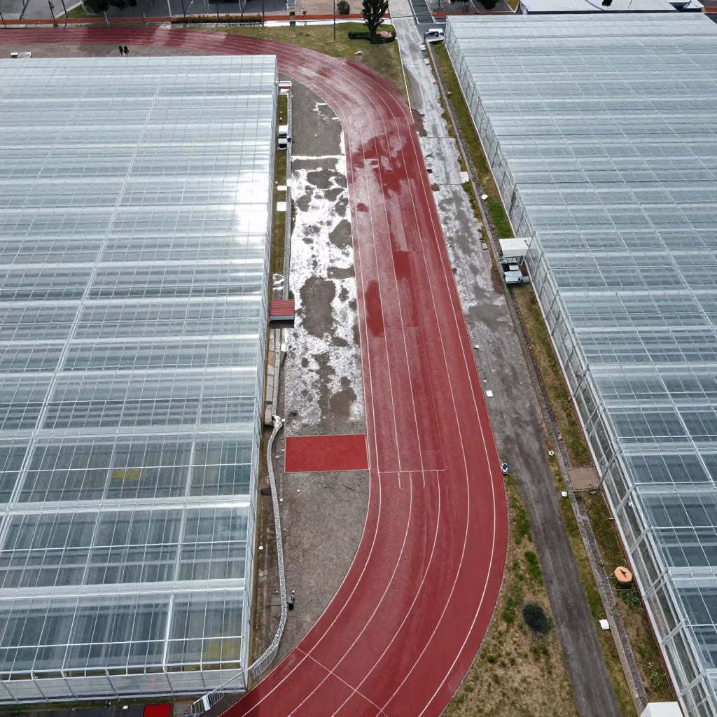
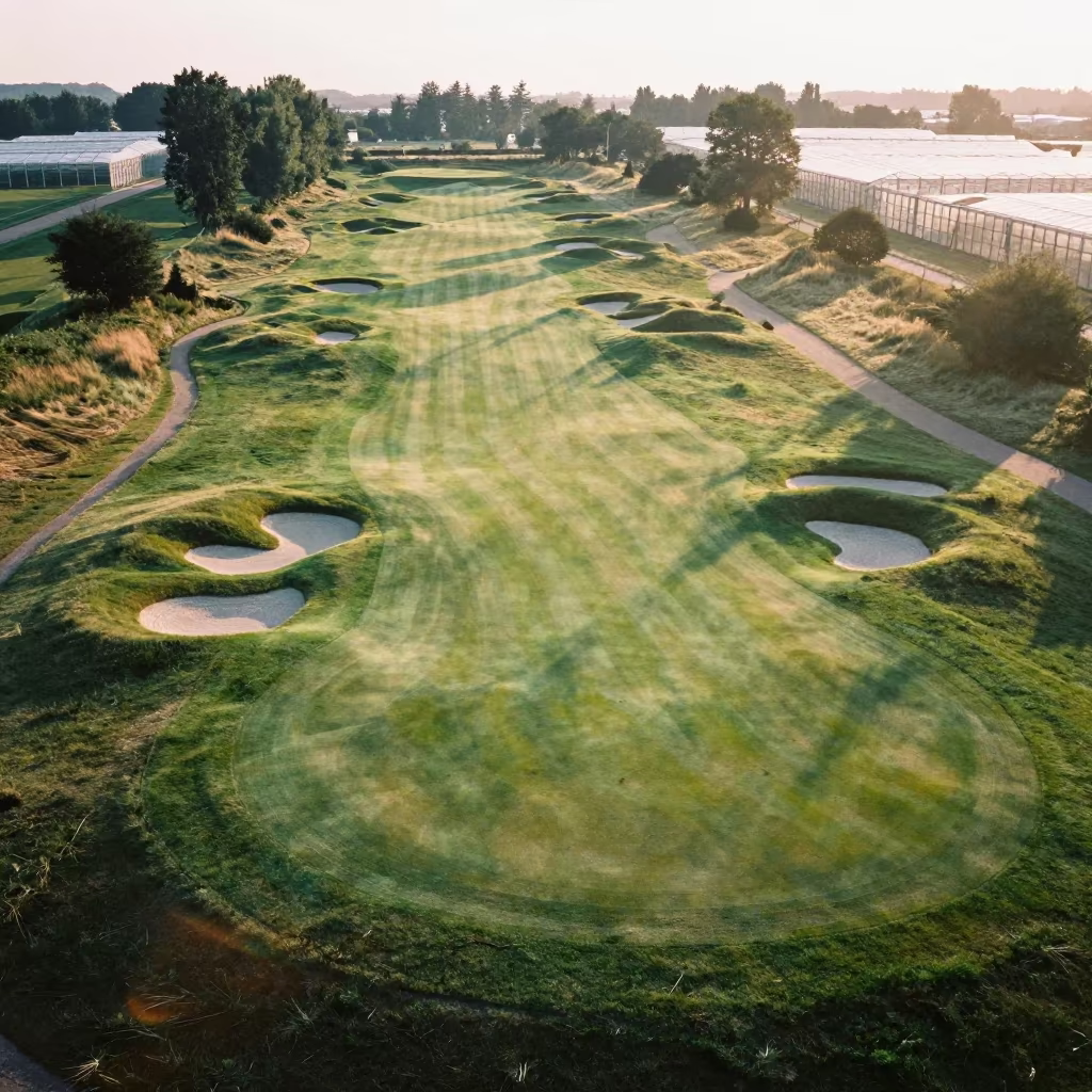
Aerial View of Sports Complex Near Greenhouse Grids
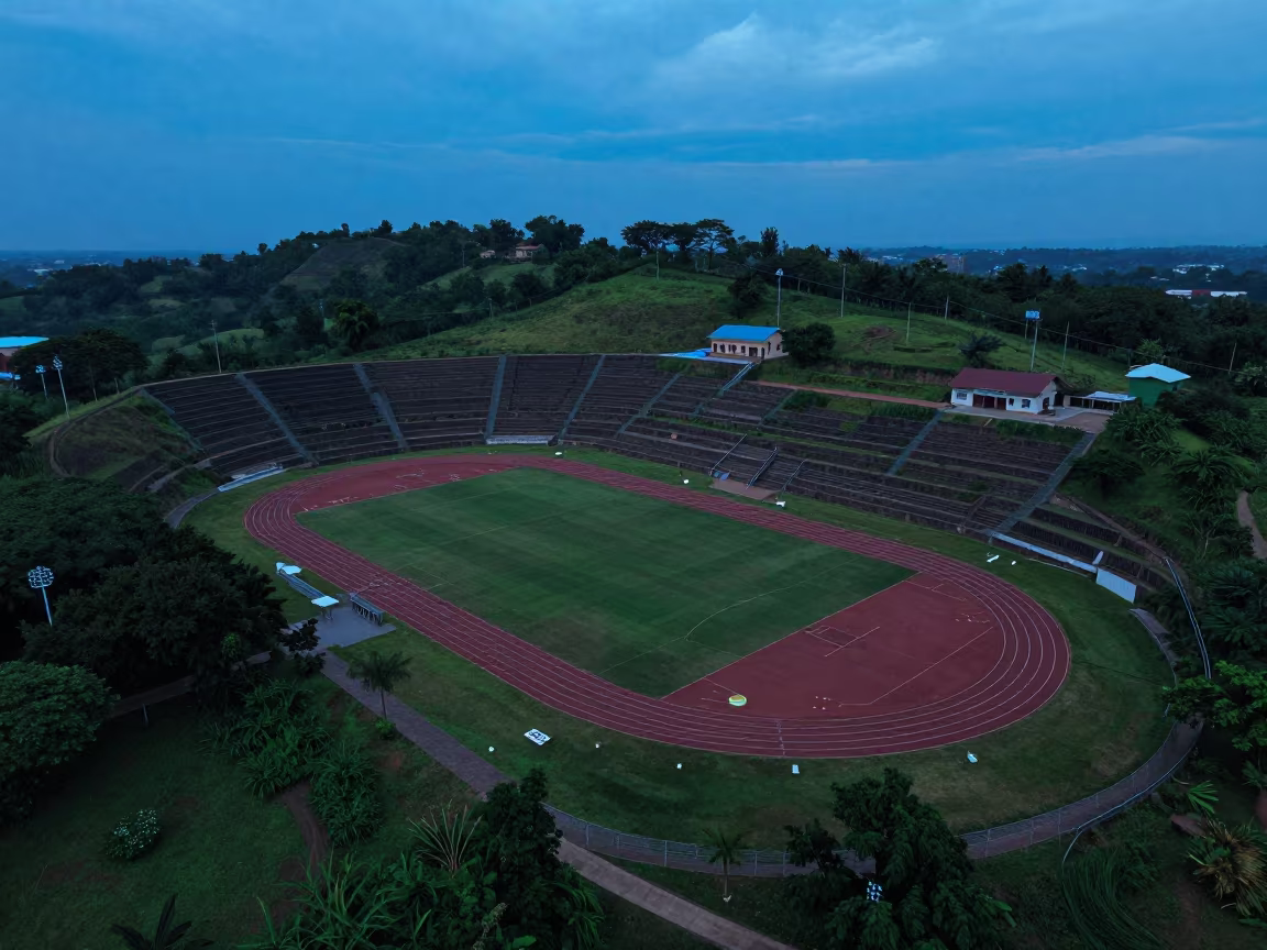
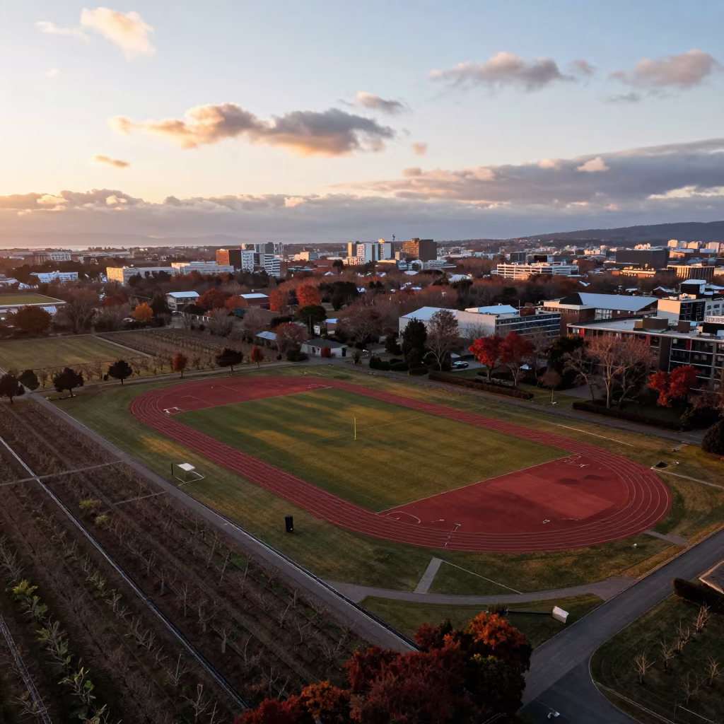
Twilight Aerial View of Sports Complex on Terraced Hills
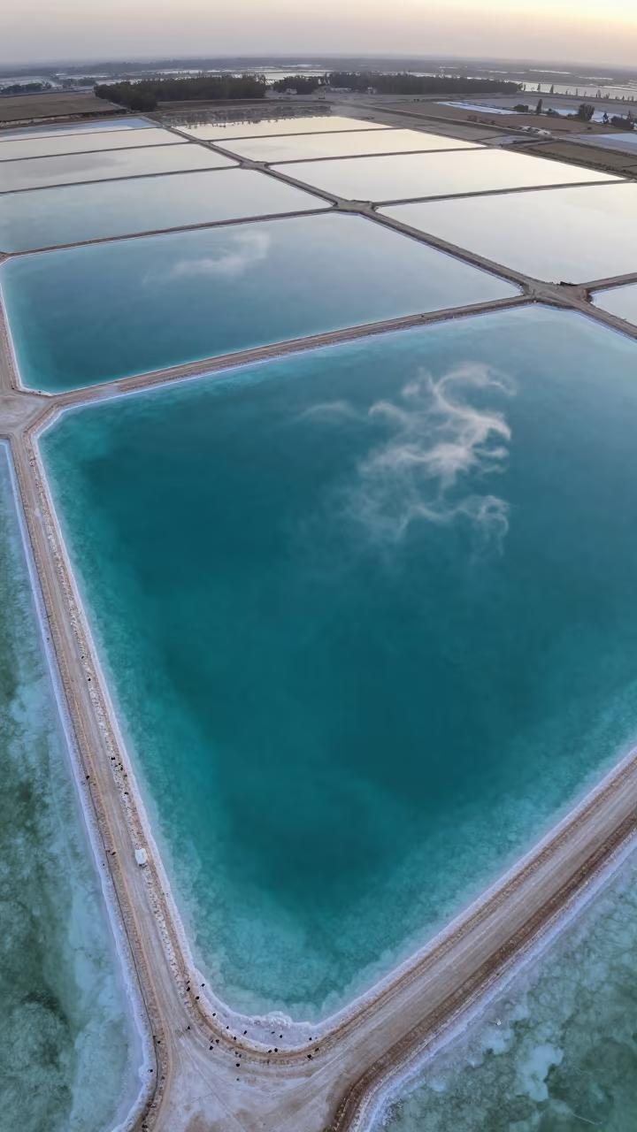
Turquoise Salt Ponds and White Sand Aerial View
Dawn Shadows Over Irrigation Geometry Stadium
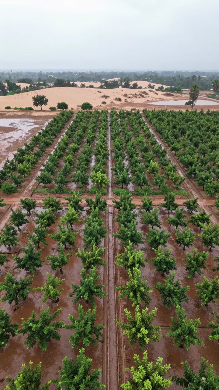
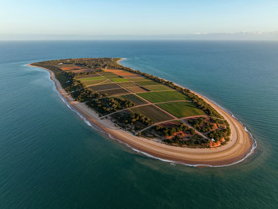
Aerial Orchard Grids Beside Dunes
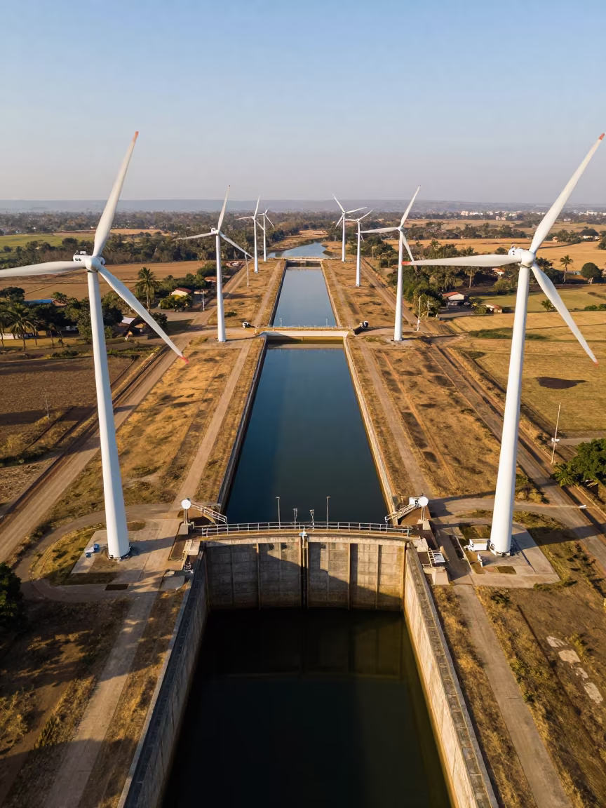
Drone View of Wind Turbines Over Canal Lock
Aerial View of Taiwan Irrigation Canals at Low Tide
Aerial Stadium View Oaxaca Monsoon Afternoon
Aerial View of Desert Tracks in Peruvian Orchard
Aerial Golf Course Bunkers Salt Ponds Victoria
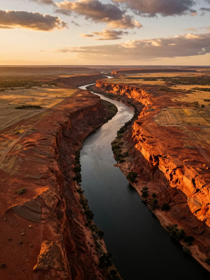
Golden Hour River Canyon Irrigation Western Australia
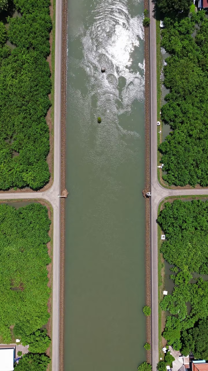
Aerial View of Irrigation Channels Near Bangkok
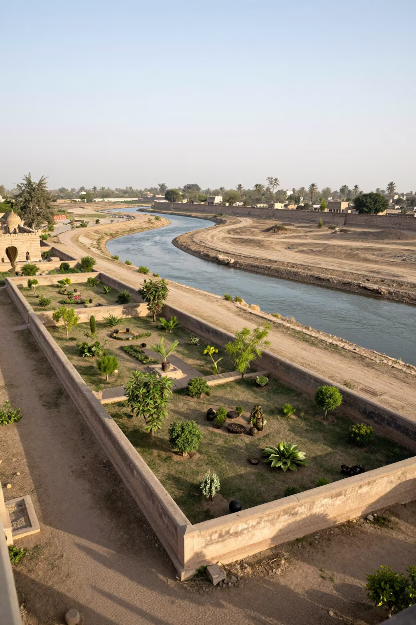
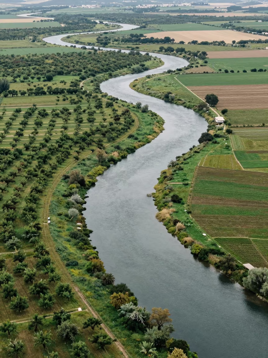
Aerial View Walled Garden River Meanders Karachi
Croatian Golf Course Aerial View Sunrise
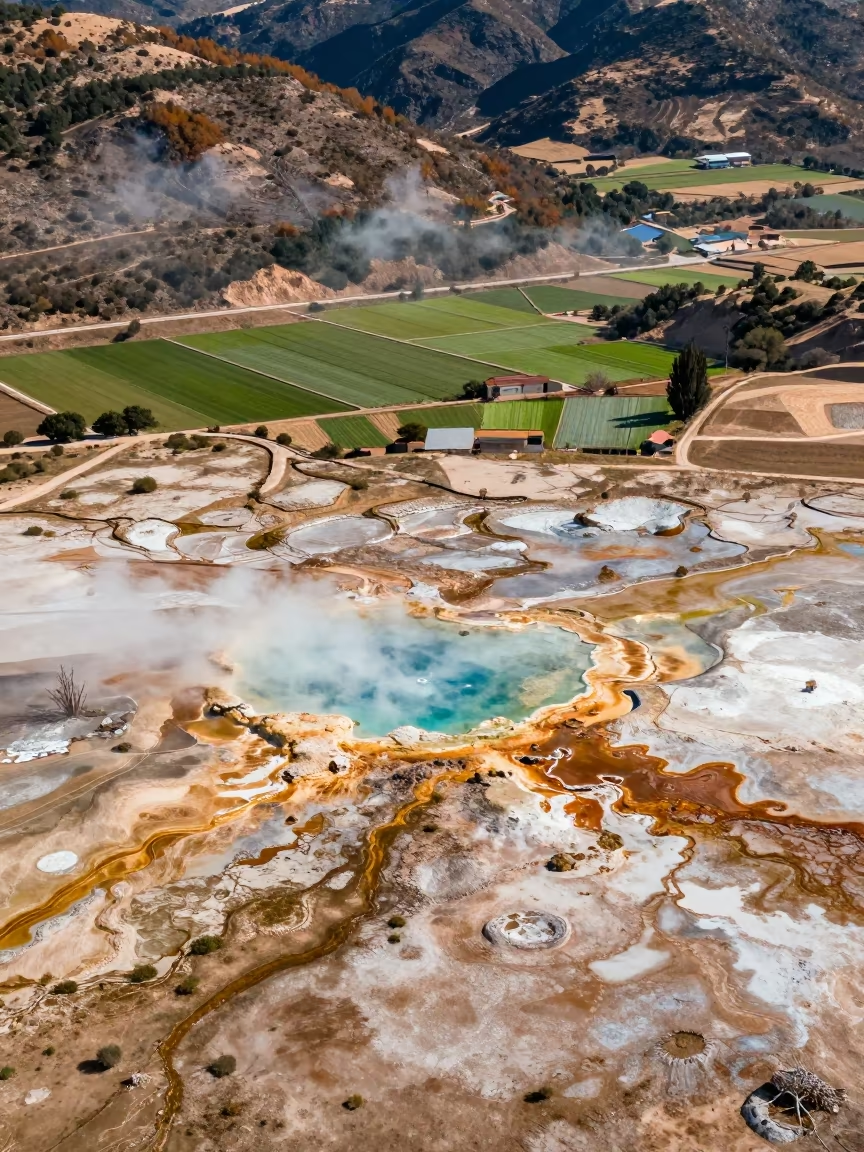
Aerial Geothermal Springs Spain Irrigation Geometry
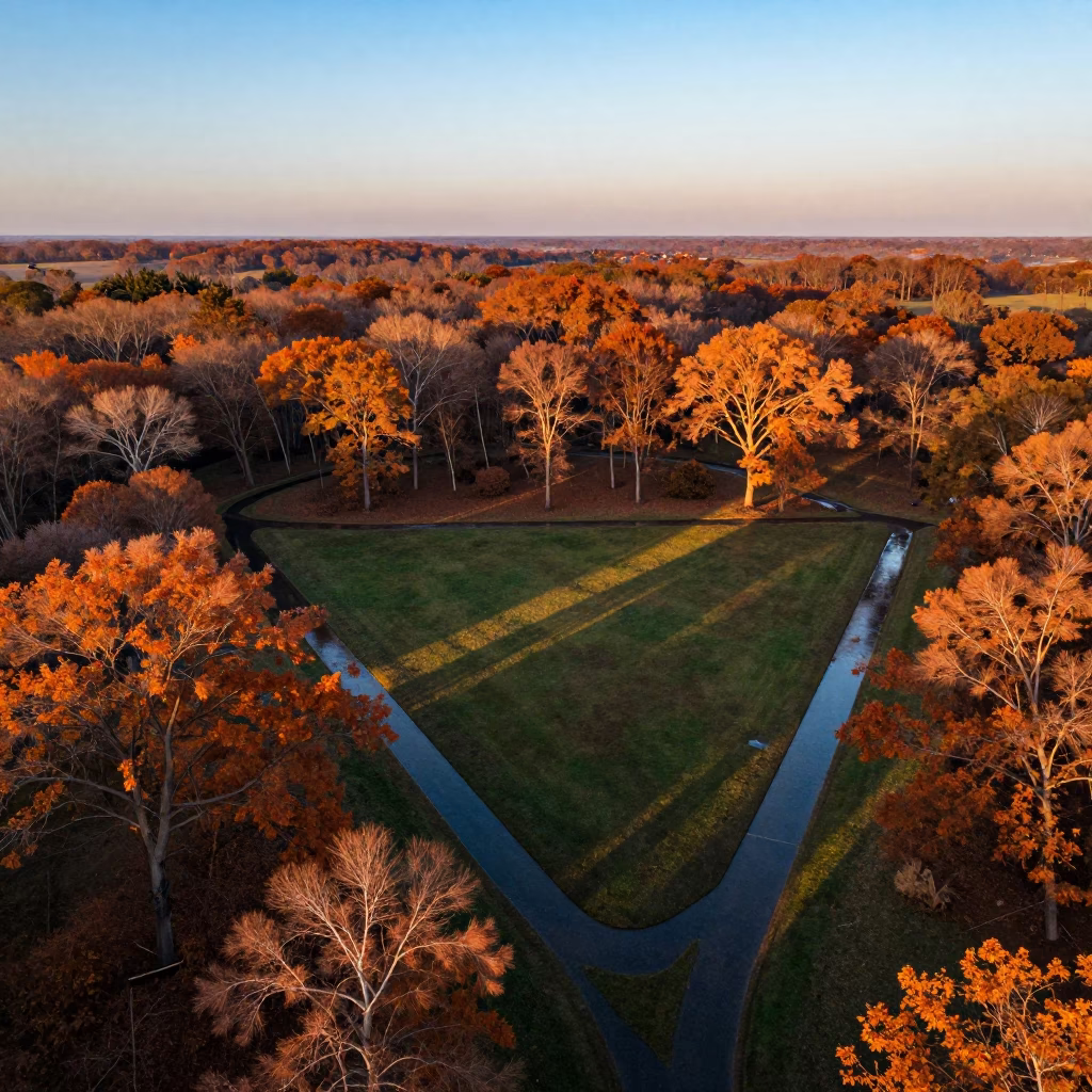
Aerial autumn forest sunset irrigation geometry Arua
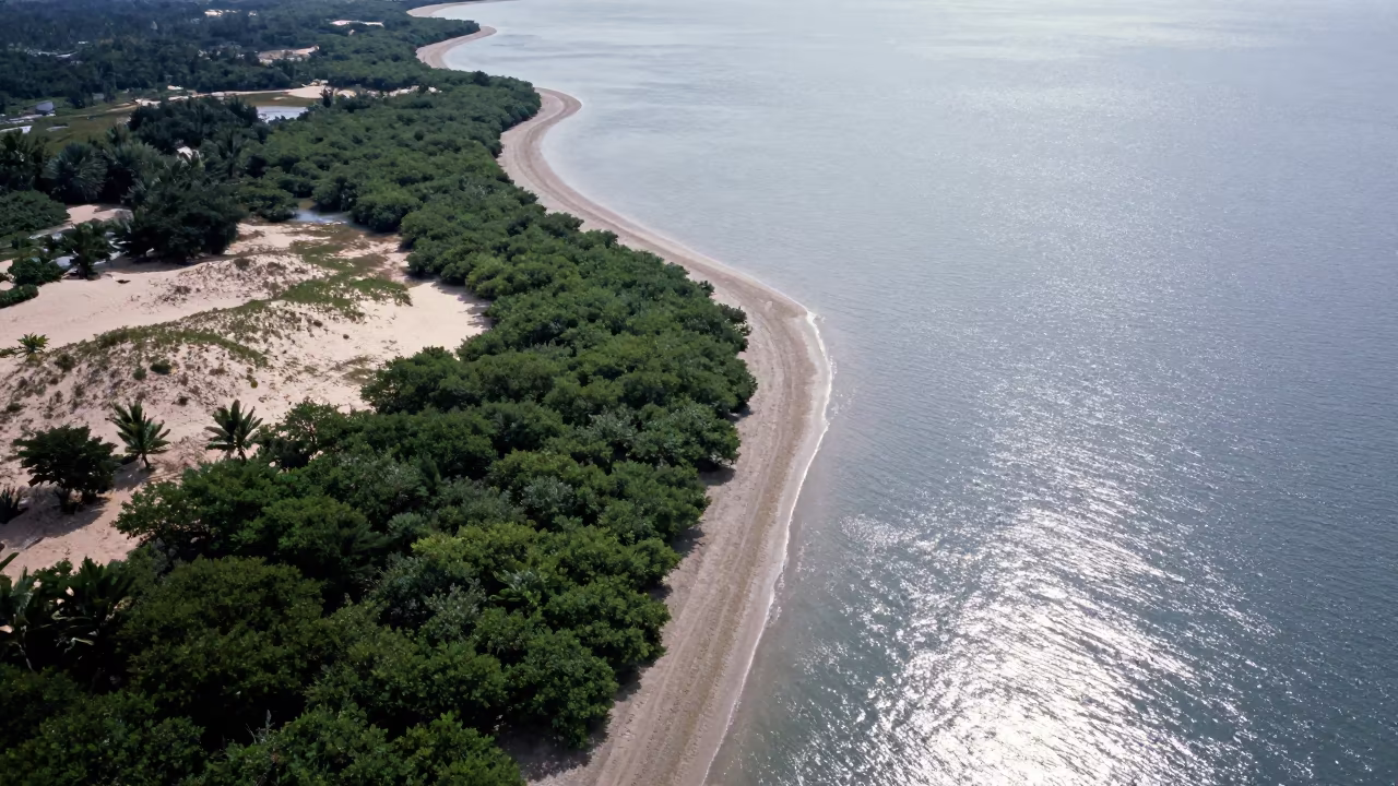
Aerial View of Malaysian Mangrove Coastline and Open Water
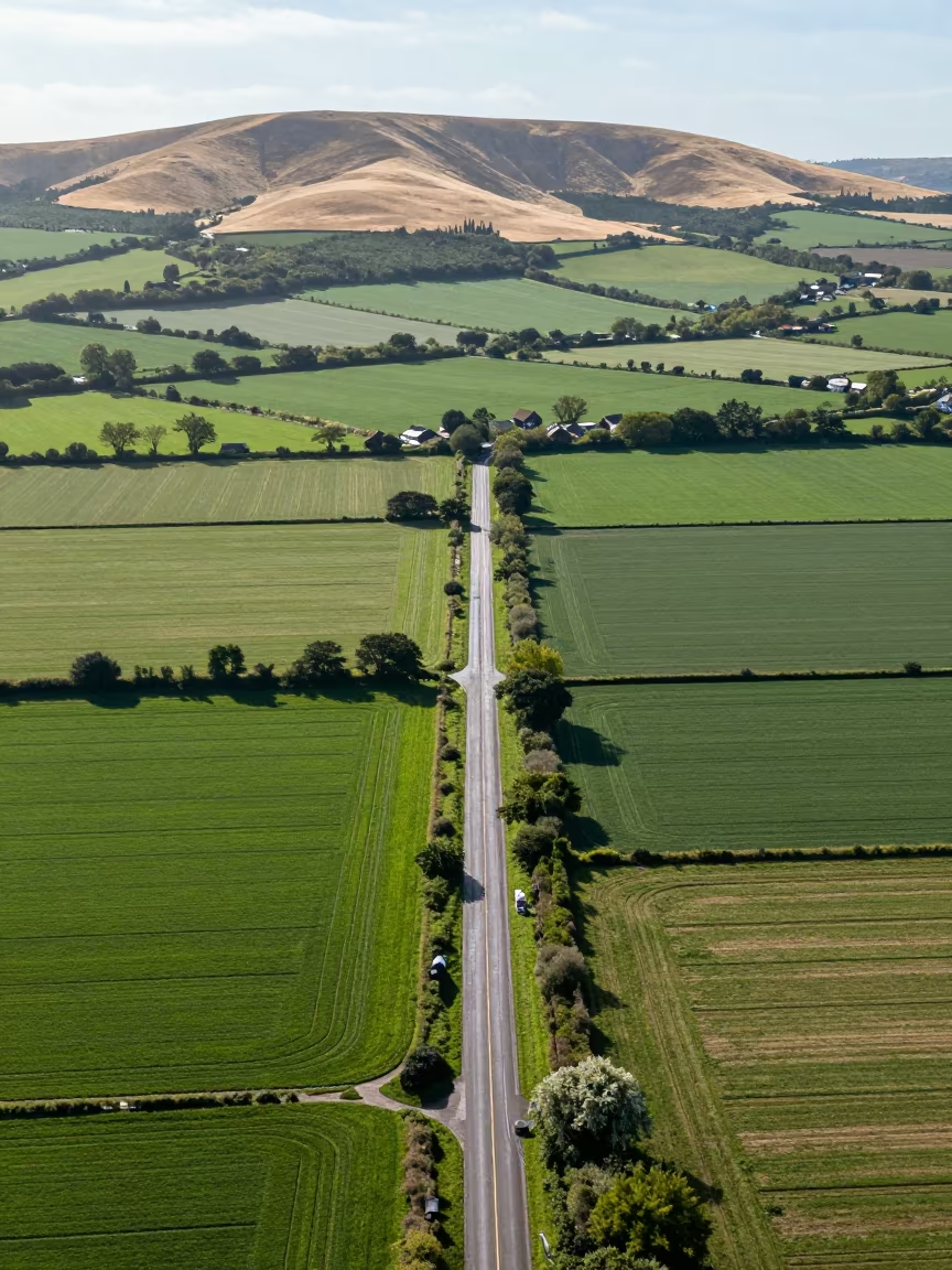
Aerial View of Country Lanes and Irrigation Fields
Aerial View of Salt Ponds Nicaragua
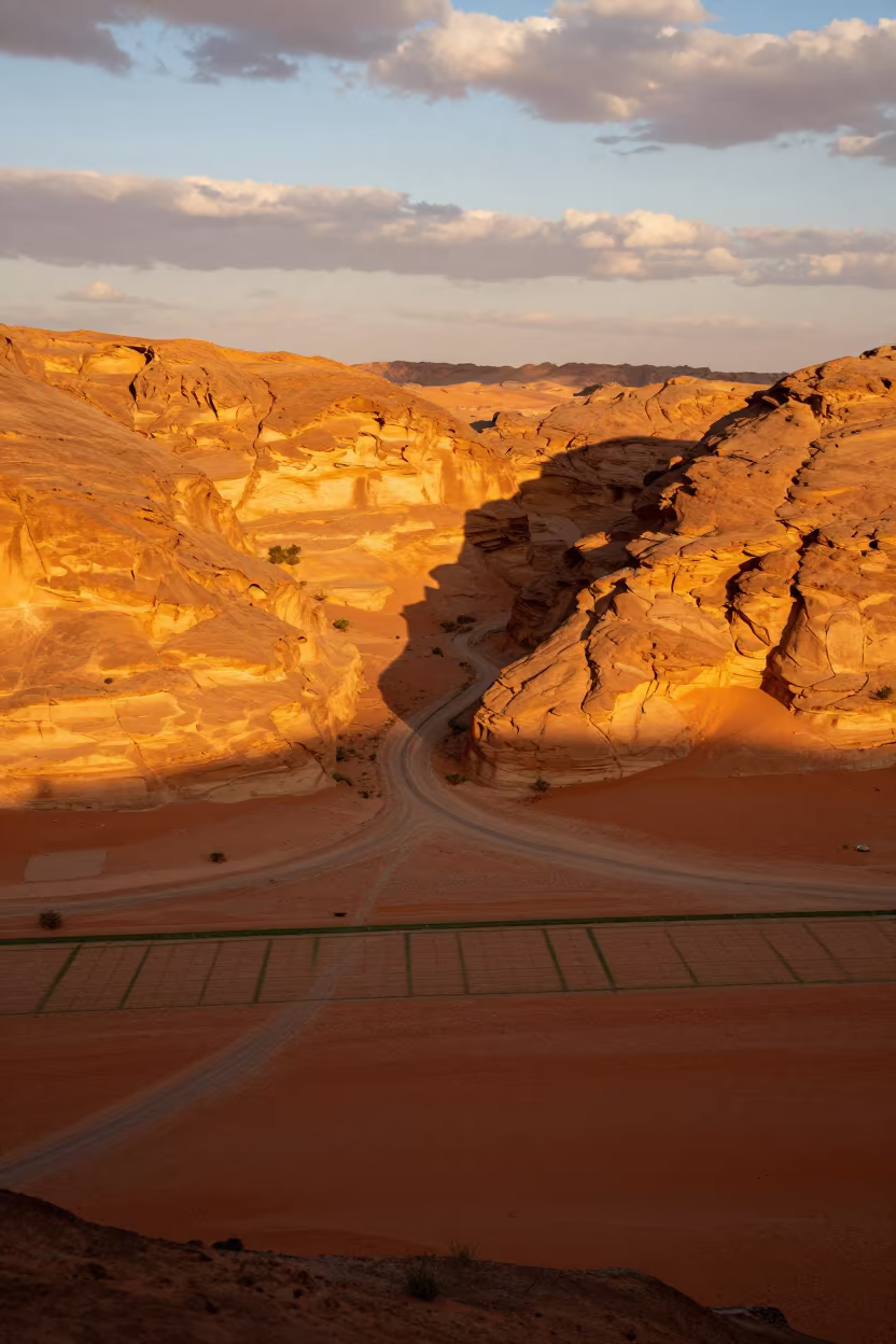
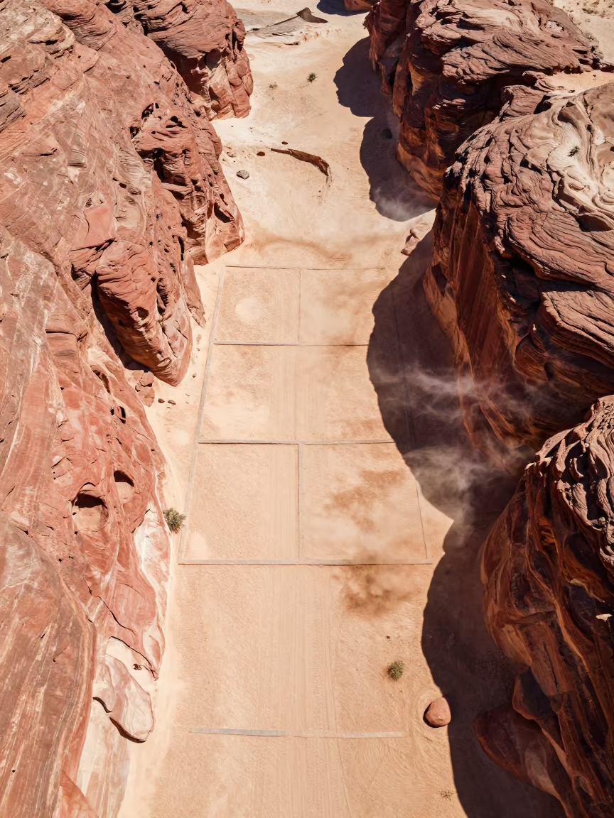
Canyon Shadow Slicing Ochre Plateau Riyadh
Aerial Forest River Comoros Irrigation Geometry

Aerial View of Wind Turbines Over Salt Ponds
Aerial River Green Marsh Greek Islands
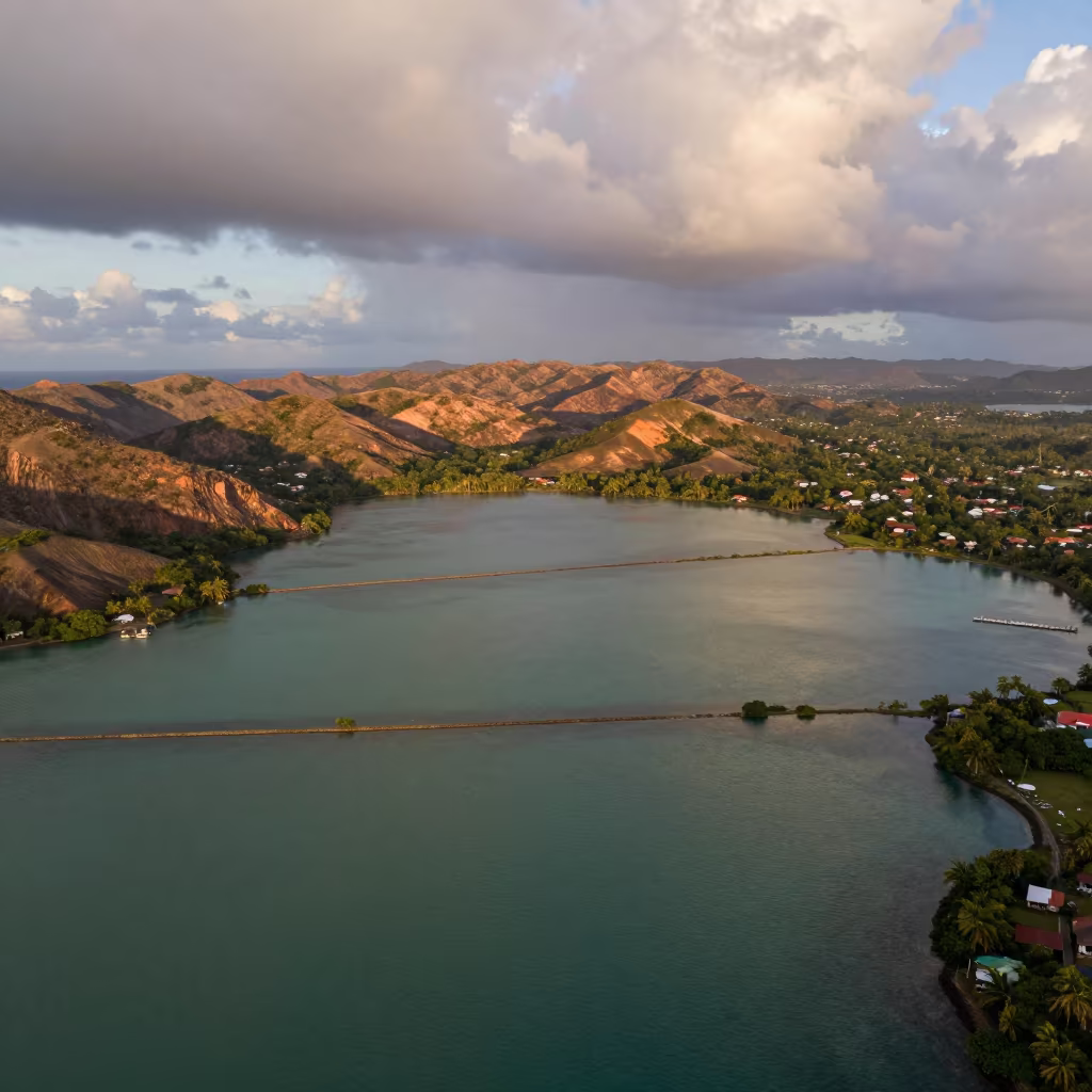
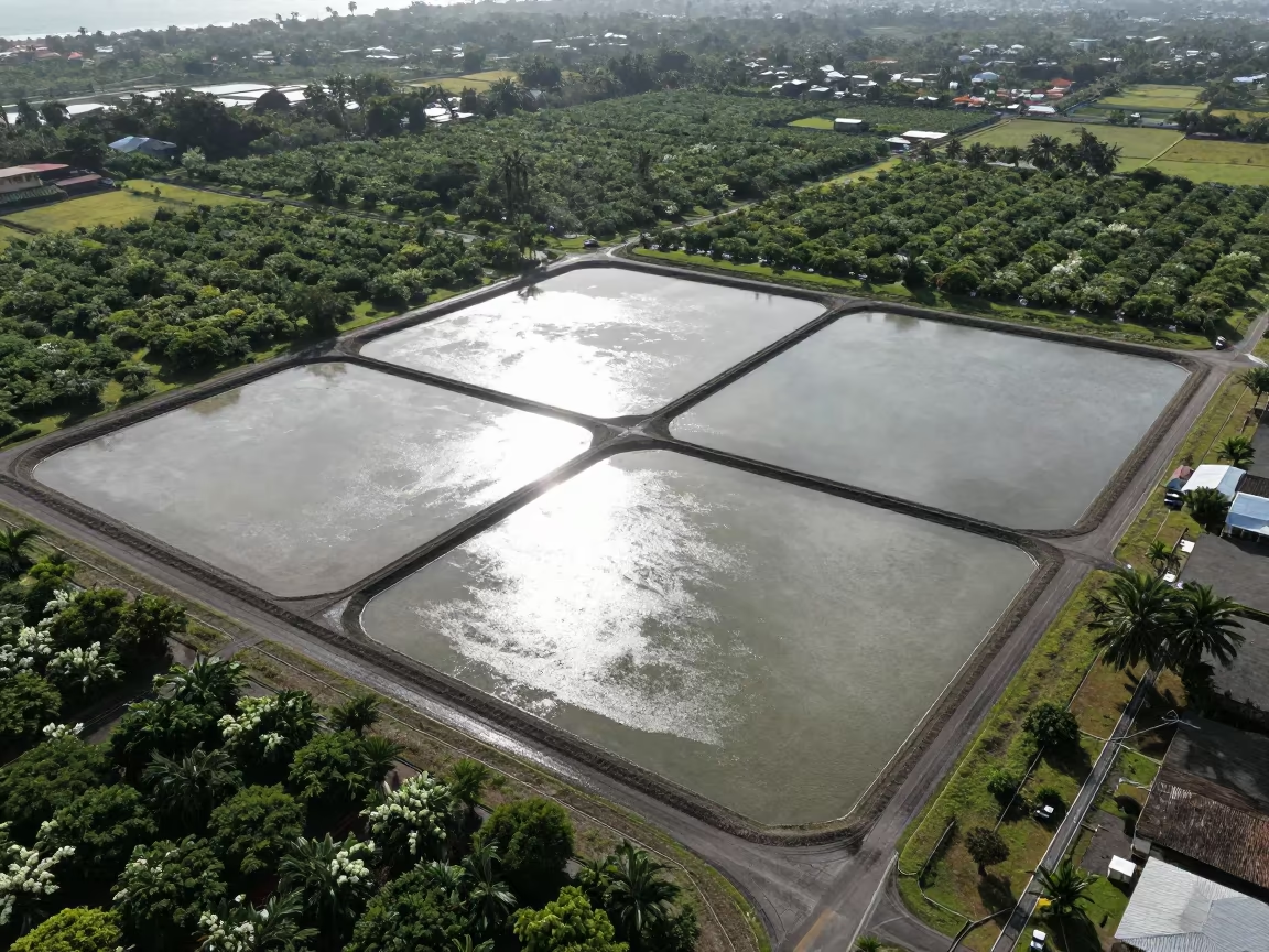
Trinidad Lagoon Jade Geometry Copper Light
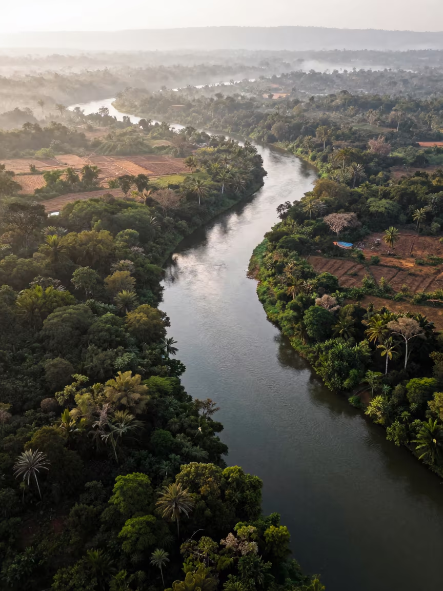
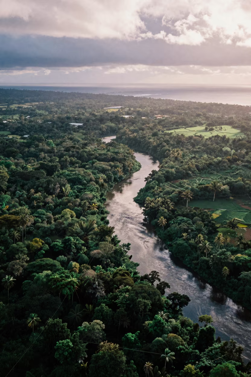
Aerial View of Serpentine River Through Jungle Canopy
Aerial View of Desert Canyon Red Walls Abu Dhabi
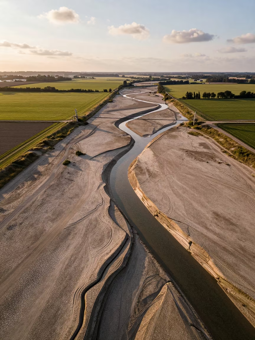
Dry River Bed Veins Aerial View
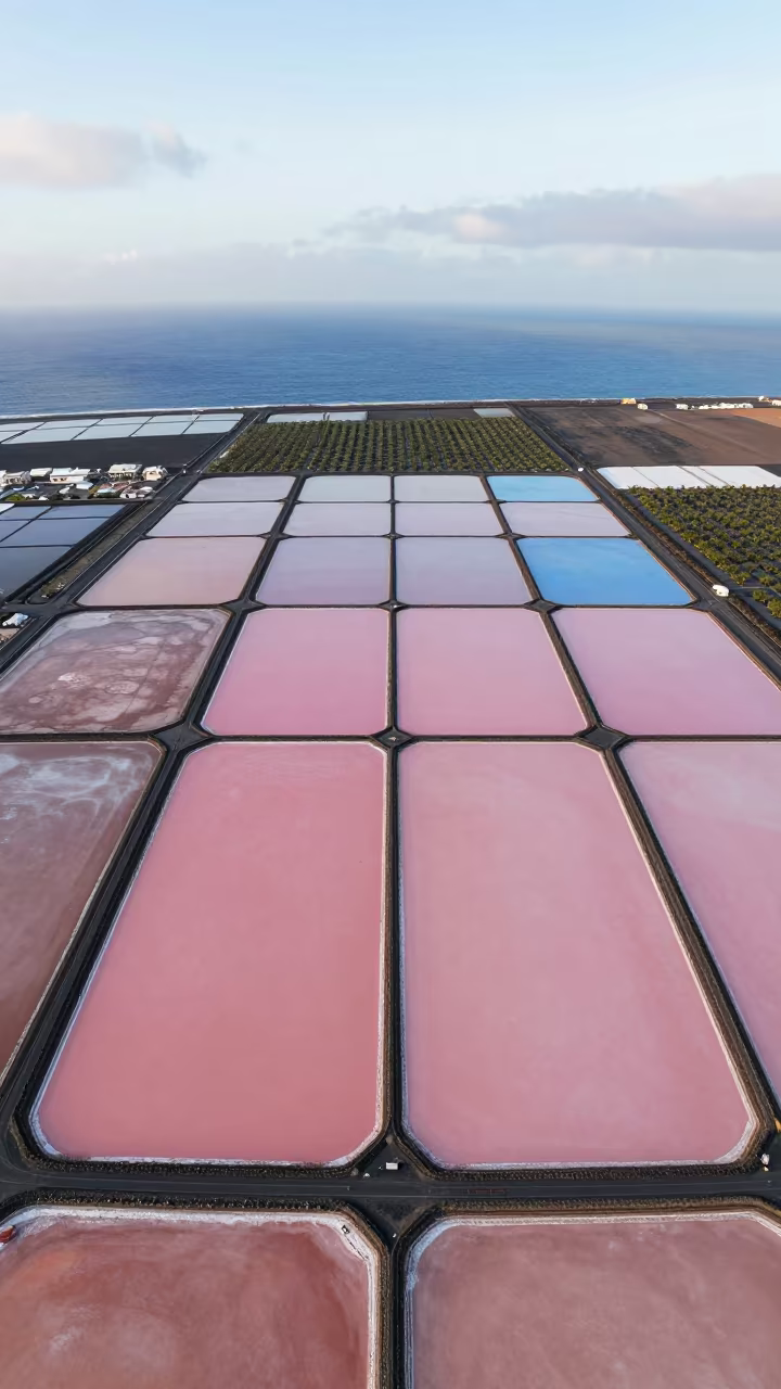
Pink and Blue Salt Ponds Aerial View
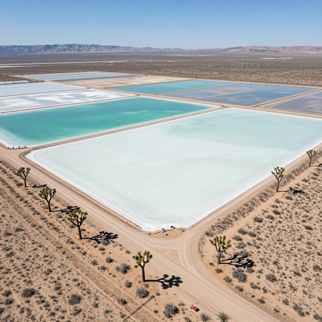
Aerial Desert View Joshua Trees Salt Ponds Utah
Comments